skip to main |
skip to sidebar
This is just a short blog about an interesting development in the Arctic. I keep a frequent lookout on websites such as NSIDC's Arctic Sea Ice News and importantly Neven's Sea Ice Blog.
One of the big predictions for forthcoming years is the collapse of the Arctic ice cap which may happen as soon as in just a few years. This graph makes it quite clear what will happen:
It's a scary graph and implies that we'll have a September minimum of 0Km3 as early as 2015; an August ... October minimum of 0Km3 as early as 2016 and a July minimum of 0Km3 as early as 2017. That is, a rapid collapse of the Arctic sea ice. However, there are wide error bars, and so future predictions should be treated cautiously.
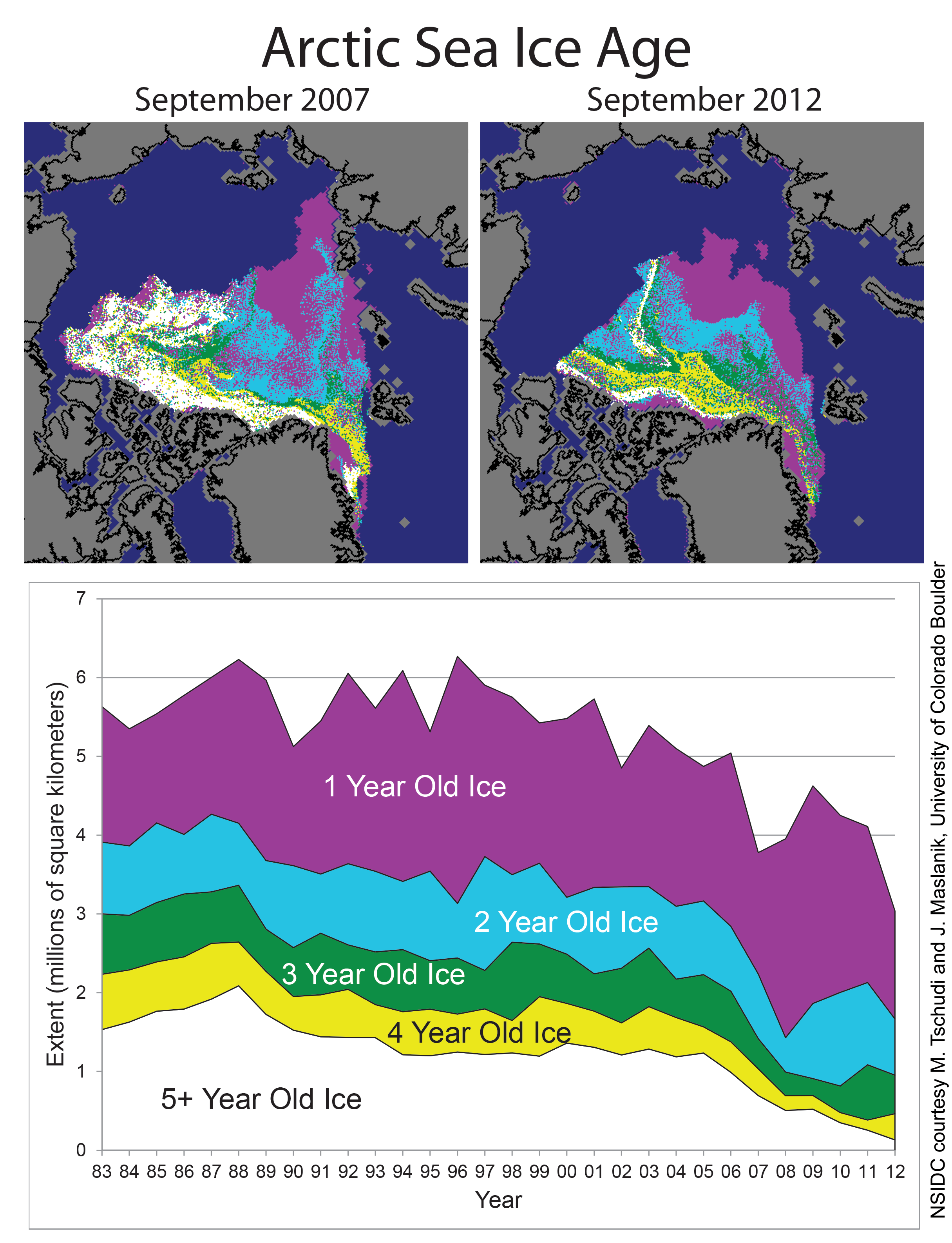
In the arctic much of the ice disappears every year (first year ice), but some remains (multiyear ice). The resilience of Arctic sea ice depends upon multi-year ice, because it's thicker. Most of the multiyear ice was lost in 2007 and has progressively depleted since then.
As you can see, most of the remaining multi-year ice (about 20% of ice >=4 years) clings to the North Coast of Greenland and islands North of Canada and the thinking is that any ice that clings on beyond 2016 or so will be there. This might not happen. Here's why. There's regular arctic ice being churned out from the Fram Strait, the sea between Greenland and Svalbard thanks to Arctic ocean currents that head up North round from the Atlantic (the same currents that give the UK warm weather). You can see it here:
It's thought by some Arctic observers that the multi-year ice is held in place at the top of Greenland by what's called the Wedge. This may get swept out through the Fram strait in just a couple of days. It'd be the big Wedgie for the Arctic and would have serious consequences for the remaining multi-year ice and whether the Arctic sea ice would in fact trend to around 1MKm3 or nothing at all. Here's a model of the process:
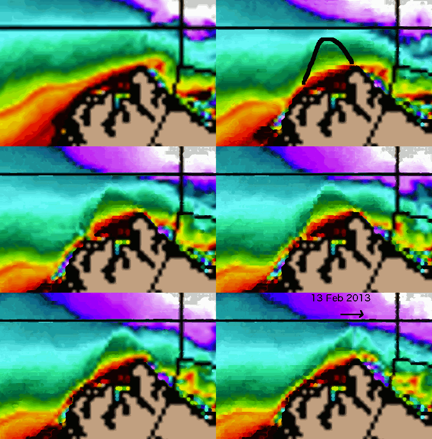
The reason why it can get swept out now, is because the ice is so thin elsewhere in the Arctic, on average, it's just over 1metre thick. Since we know that with thinner ice sea currents have more opportunity to influence Arctic sea ice and in recent weeks observers have noticed a number of cracks appearing in the Arctic sea ice, early than they would be expected (large cracks do occur in the ice, just not normally this early, here):
(It's a false-color image so you can see the contrast more easily, Greenland is bottom right, cracks are shown white against orange).
Of course, it might not actually happen - I'll post a comment in a few days if it does!
Or rather we won't as in a few years it'll all be gone!
This is a little blog about current Arctic Sea Ice Area as we near the 2012 record-breaking summer minimum.
Take a look at the image:
It's a section of the Arctic SIA as of yesterday.
We can see that the whole of the top-right hand edge, is the Northern Sea Route. You can see it's open-water and there's a lot of it. It first opened in 2009, but right now it's so wide you could pretty much sail the UK straight through; and within 3 years!
The opening of the Northern Sea Route means that ocean currents can sweep more easily round the eastern edge of the North Pole; bringing warmer waters from the Gulf Stream (not to be confused with the Jet Stream); and thus accelerating the collapse of the Arctic Sea Ice. We can see the effect quite clearly; the eastern edge continues to melt significantly, just days away from the supposed end of the melting season.
By contrast the Western edge of the Arctic Sea Ice is pinned by an extensive set of islands as well as the all-important Greenland land mass. This is why the Sea Ice is clinging to that edge, the frozen land keeps it cooler and protects it from ocean currents.
The last thing to note is the colour scheme. Red means '60%' ice, pink means '80%' ice; purple is near 100%. This means that the white dot in the middle, which is the North Pole itself, is only 80% Sea Ice at best and has a large amount of 60% (i.e. rotten) Sea Ice relatively close by. Given that the Eastern edge of the ice is about half-way to the North Pole, I'd guess it'll be gone within 3 years.
SIA Later, in a week or so for my post on the Arctic minimum!